Client
Geo-Informatics and Space Technology Development Agency
Project
Website/Application
Year
2023
Services
About Project
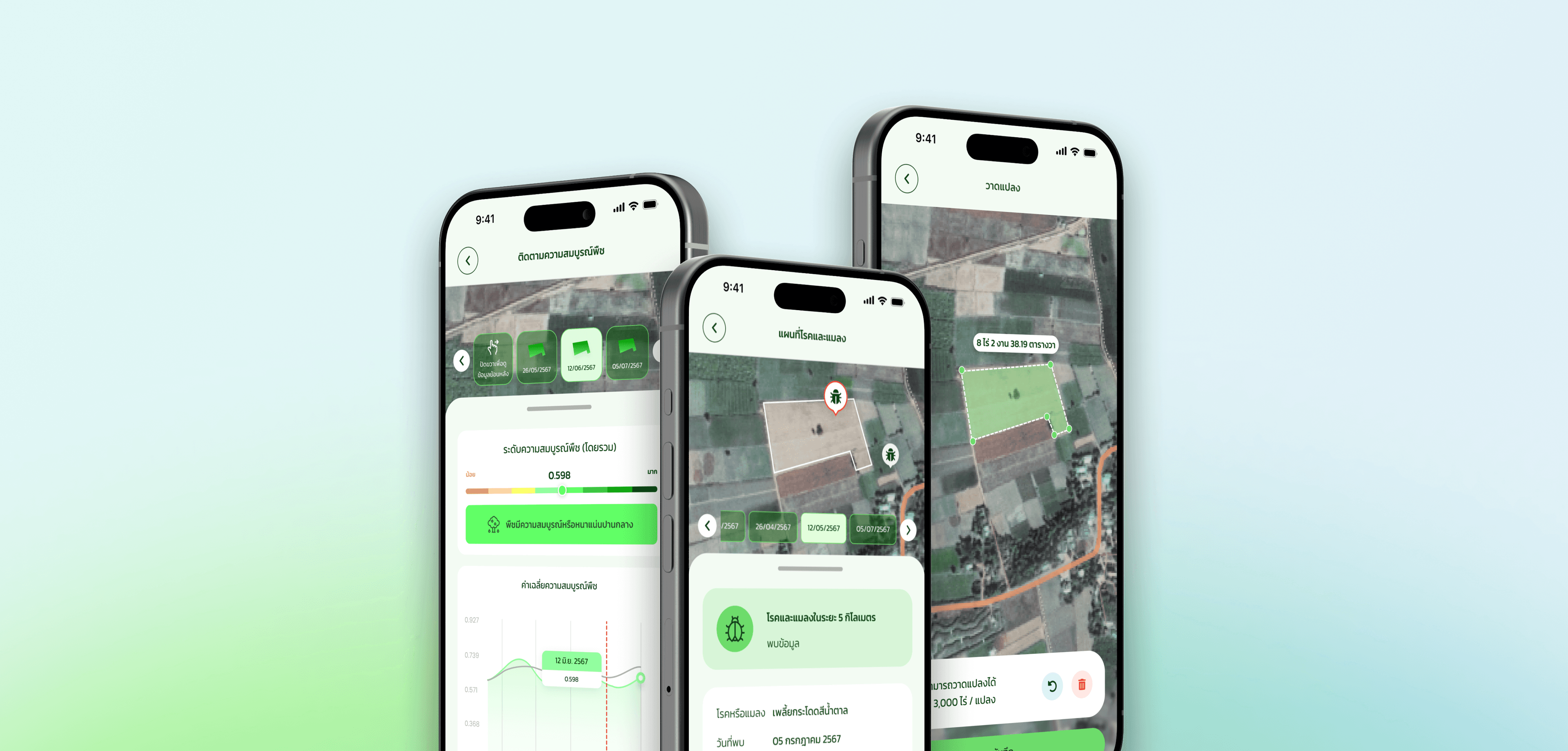
Satellite-based remote sensing and geospatial technology is a key category of digital technology that plays a vital role in agricultural land management. It supports the implementation of modern, efficient, and precision agriculture by capturing Earth surface data across multiple electromagnetic wavelengths. This allows for wide-area coverage and repeated observations, making it highly effective for monitoring changes over time. These capabilities enable farmers to monitor crop cultivation, assess field conditions, estimate and forecast yields, evaluate crop health, detect pest and disease outbreaks, and track weather patterns to reduce risks of yield loss. Furthermore, big data—particularly high-resolution, real-time bio-physical and environmental data both within and outside the farm (e.g., soil, water, weather, crop conditions)—is essential for accurate and data-driven decision-making. As such, there is a growing need to develop this concept into a practical and tangible solution through the creation of accessible web platforms and mobile applications.


Challenges
Develop a platform for delivering agricultural geospatial information and related data to support farmers in effectively managing crop cultivation.
Conduct analysis and design of a user-friendly system tailored for farmers, eliminating the need for prior expertise in geospatial information.
To promote knowledge and understanding in the utilization of digital, plot-based agricultural platforms as a means to strengthen the local economy.
Style guide


Outcome
The Dragonfly digital agricultural platform, designed for plot-level management, enables farmers to track, monitor, predict, and access dynamic data to make informed decisions that are timely and relevant to their farming operations. It offers a comprehensive solution for planning and managing crop fields from planting to harvest, helping farmers optimize their entire agricultural process. By utilizing precise and modern space technology and geoinformatics, the platform ensures accurate and up-to-date insights for better decision-making.


